My plan for Saturday was to ride out to Mt. Gleason, Mt. Wilson, and Mt. Disappointment. Since I am still in the process of gradually ramping up my weekly mileage, the only way I could do this ride was to start from the other side of the mountain, in La Crescenta. Starting from Santa Clarita would add another 60-70km—more than I am ready to do at this moment. My hope was to wake up at 5:00 a.m. to eat, warm up, and stretch; get my gear packed and my bike loaded on the car by 7:00 a.m.; and arrive in La Crescenta before 8:00 a.m. Lately, I have been having difficulty waking up early on Saturday morning, and Friday night I was up late: I knew getting an early start was going to be a long shot.
Of course, when the alarm woke me up at 5:00 a.m., I was dead tired. I turned it off and thought about it for a while. The lazy side of me was quick to throw out some really good sounding excuses for changing my plan. “Listen to your body. You are tired. Take it easy!” I have to admit, I nearly convinced myself not to get up and go. I even tapped the “snooze” button a few times before dragging myself out of bed.
Unfortunately, it took me a bit longer to pack up my gear than I wanted. I usually pack everything up the night before, but I just was not able to do that this time. Unfortunately, it was another late start. I did not roll out from the starting point until 9:51 a.m. Ugh!
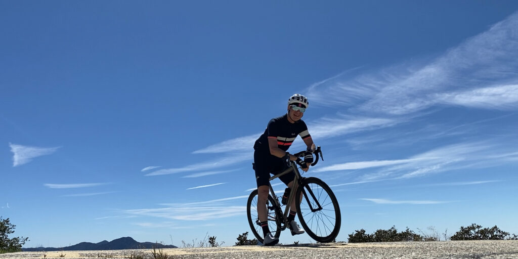
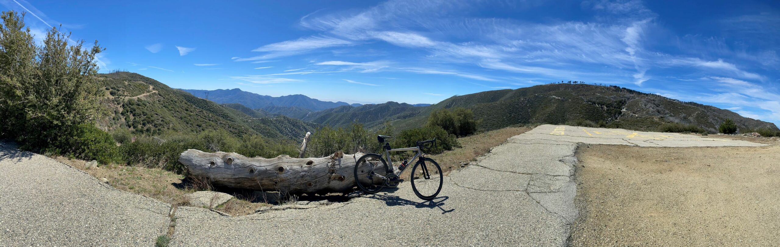
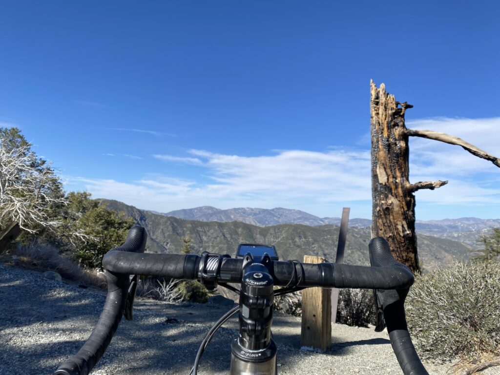
It was sunny, warm, and windy—but not as windy as last week! This route took me up Big Tujunga for a nice little warmup climb, then across Angeles Forest Highway to Mt. Gleason Road up to Mt. Gleason, then back down and across Upper Big Tujunga Canyon Road to Angeles Crest Highway, heading towards Mt. Wilson. At Mt. Wilson Redbox Road, I made the climb up to Mt. Wilson, and the climbed Mt. Disappointment on the way back, before descending Angeles Crest Highway and heading back to the car.
Before descending Angeles Crest Highway, I stopped at the Red Box ranger station to refill my water bottles. Red Box is one of my favorite places to stop on a long ride, especially when I am riding solo. There are usually several other cyclists congregating near the steps leading up to the water fountain. Some riding solo, some in groups. Some on the way up to Mt. Wilson, some on the way back down the mountain. Some heading over to Mt. Gleason. Some I have met before, some I meet for the first time, some I may never see again. Regardless, the camaraderie in those moments, forged from our shared experience out on the road is a wonderful thing: Something akin to catching up with loved ones for the first time in a long while, at a holiday meal. Then, the moment fades; riders clip in and roll out to their respective destinations, sometimes together, sometimes alone.
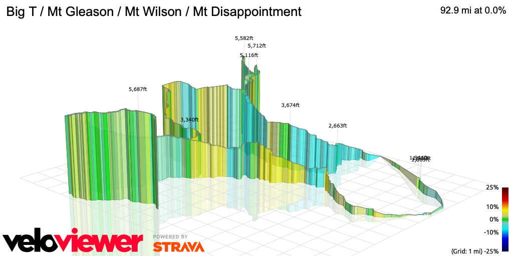
In total, the ride was about 144km (92 miles), with just over 3,200m (10,498 feet) of climbing. I had intended to do a loop of Angeles Forest Highway, Upper Big Tujunga, and Angeles Crest Highway (an additional 42 km, with 997 meters of climbing) before descending Angeles Crest Highway. However, due to the late start in the morning, it was much later than I had planned. I decided to call it a day and enjoy the fast descent into the city.